
Use additional data
In the last step of the wizard Create new territory structure... you will be asked on which sheet and in which map you want to insert the layers of the territory structure. In addition, you can optionally link additional data from another table with the basic data of the areas. Additional data includes all data that is not necessarily required for the administration of the territory or is not characteristics of the territory in the narrower sense, such as sales figures for the territory.
Of course, you can also add additional data after creating the territory structure - add additional data.
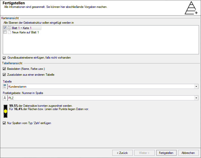
Map View
Check the box for the map in which you want to display the structure you just created. You can also select multiple maps for display. The structure is also shown on maps that do not have the same base as the structure.
Via Insert basic blocks, if not available you can insert your structure with the basic blocks on the selected sheet.
More information about the inserted layers in the map view can be found here.
Table View
If you check Basic data (name, color, etc.) , additional one or more Work tables will be created and opened. You also have the option of completing these work tables with data that already exists in EasyMap. Simply activate Additional data from another table and select the desired data table. The additional data table must have a column with the numbers of the basic block level (e.g. postal code) so that a link can be created.
By checking the box in Insert only columns of type "Number", you can append all number columns of the selected table to the basic structure data.
After you have created the territory structure, you can add Locations to each level. You can find out how to do this here.
